Drone 3D scanning and digital twins
A 3D digital twin of your structure, from every angle.
Our licensed drone pilots capture buildings, towers, bridges, ships, historic structures and sites from every angle on flights planned around each structure; our own processing pipeline turns the photos into point clouds and textured 3D models, delivered in Göksuret Cloud.
Our pilots come to your site and capture the structure from every angle on planned flights; we turn the photos into point clouds and textured 3D models in our own processing pipeline and deliver them. Our work is capture and visual delivery; we do not provide official mapping or cadastral surveys.
3D scanning
Every structure gets its own flight.
Every capture is planned around the shape of the structure; tower, bridge, building, ship, pylon or interior, the result is the same: a textured 3D model with every surface seen. Scroll to watch.
Tower capture
Telecom towers.
The tower body, antenna panels, fittings and equipment shelter are documented in the textured model and in close-up photos. One record for antenna inventory and visual inspection, without climbing.
- Antenna and equipment inventory
- Close-up photos
- Inspection without climbing
Top, sides, piers and underside
Bridge Scan.
The deck top, the girders on both sides, the piers and the deck underside merge into one model. Girder undersides and bearings are documented up close without scaffolding or platforms. The heatmap shows every surface reaching full coverage.
- Deck underside and bearings
- Close-up without scaffolding
- Top, sides, piers, underside
Buildings
High-rise or low-rise, every facade.
High-rise or low-rise; every facade, the roof and the surroundings are documented in the textured model. Cladding, windows, roof and parapets are delivered together with close-up photos.
- Every facade
- Roof and parapets
- High-rise and low-rise
Maritime
Hull, deck, superstructure.
With the ship alongside or in dock, its hull, deck and superstructure are documented in the textured model. Paint, corrosion and damage findings are marked on the model, a visual record for maintenance and refit planning. Below the waterline is not scanned; the ship must be in dry dock for the underwater hull.
- Hull, deck, superstructure
- Paint and corrosion record
- Underwater out of scope
Transmission lines
Pylons, crossarms, insulators.
The pylon body, crossarms, insulators and fittings are documented in the textured model and in close-up photos; one record for inventory and visual inspection. Thin lattice members are limited in photogrammetry; we state this clearly at delivery.
- Crossarms and insulators
- Close-up photos
- Point cloud · textured model
Indoors
Indoors, too.
In warehouses and plants, walls, ceiling and the structures inside are documented in one model. The model is delivered in local coordinates; its scale is checked against a distance measured on site.
- Warehouses and plants
- Walls, ceiling, interior
- Model in local coordinates
Large sites
Large sites, repeatable captures.
Large sites are delivered as an orthophoto and a textured 3D model. The same site is captured again at set intervals, and periods are compared side by side in Göksuret Cloud.
- Orthophoto · 3D model
- Repeatable captures
- Period comparison
Digital twin
Measure, compare, share.
The textured model opens in the browser in Göksuret Cloud: measure heights, distances, areas and volumes, and see on the map where each photo was taken. Every output is delivered in open formats and opens in other software too.
- LAS/LAZ · OBJ · glTF · 3D Tiles
- GeoTIFF · PDF
- Time-limited share links
Cultural heritage
Every angle, without touching history.
Ancient cities, rock-cut tombs, rock formations, tumuli and historic buildings are captured without contact or scaffolding and turned into textured 3D models. Captures at archaeological sites are carried out with permission from the relevant authorities. Scroll to watch.
Ancient cities
The whole city, one model.
Temple, theatre, colonnaded street and foundations; the whole site and its key structures merge into a single textured model. Excavation and restoration periods are compared side by side on the same model.
- The whole site
- Key structures in detail
- Orthophoto · textured 3D model
Rock-cut tombs
Sheer rock faces, no scaffolding.
Temple and house-type tomb facades carved into the rock, with their columns, pediments and chamber entrances, are documented up close even high on the cliff. No scaffolding or rope access is needed; the rock face and the tombs merge into a single textured model.
- Temple and house-type facades
- High tombs included
- No scaffolding
Rock formations
From top to base.
Tuff cones, rock pillars and rock-cut settlements; hard caprock, carved windows and doors and eroded bases are documented in the same model. The point cloud builds up as the scan progresses, and the textured model is revealed after processing.
- Caprock and bases
- Carved openings included
- Point cloud · textured model
Tumuli
Every slope of the mound.
On tumuli and mounds the slopes, the stone crepis and the entrance passage are documented from every side; the shape of the mound is recorded in a single textured model.
- Slopes and top
- Crepis and entrance passage
- 3D record of the shape
Historic buildings
From dome to foundation.
Domed buildings, porticoes and minarets; the whole structure including dome, lead roofing, facades and the minaret balcony is documented in the textured model. Models from before and after restoration are compared side by side in Göksuret Cloud.
- Dome and roofing
- Portico and facades
- Minaret included
Whatever you need scanned.
Every capture is planned around the shape of the structure and the outputs you need.
Building digital twins
High-rise and low-rise buildings, facades and roofs are scanned from every angle; the textured 3D model and point cloud can be explored in the browser and are delivered in open formats (OBJ, glTF, LAS).
Textured model (OBJ/glTF) · LAS/LAZ · 3D Tiles · digital twin
Cultural heritage
Ancient cities, rock-cut tombs, rock formations, tumuli and historic buildings are captured from every angle without contact or scaffolding. Captures at archaeological sites are carried out with permission from the relevant authorities.
Textured 3D model · point cloud · orthophoto · raw photos
Bridge and infrastructure inspection
Deck top, girder underside and piers merge into one model. In virtual inspection you move between the scan photos aligned on the model without going to the structure; cracks, corrosion and damage are marked and shared step by step as an inspection tour.
High-resolution photos · 3D model · virtual inspection · inspection tour
Ships and shipyards
The hull side, deck and superstructure of ships alongside or in dock are scanned. Paint, corrosion and damage findings are marked on the textured model as a visual record for maintenance and repair planning.
Textured 3D model · hull photos
Telecom and power
Equipment inventory and visual inspection of telecom towers, power pylons and substations — without climbing and without shutting down.
3D model · inventory photos · measurements
Indoor scanning
Indoor scanning in warehouses and plants. The model is delivered in local coordinates, with its scale checked against a distance measured on site.
Local-coordinate 3D model · point cloud
How it works.
Four steps. Follow each one in Göksuret Cloud.
- 1
Request
Draw the area on the map
In Göksuret Cloud you draw the area, choose the purpose and the outputs you need. Ask for a one-off capture or a regular one (weekly, monthly).
- 2
Capture
Licensed pilot, permit, insurance
Our team plans the flight: a licensed pilot and drone are assigned; flight permit, insurance, weather and site briefing go through a checklist. On the day we coordinate with your site team.
- 3
Processing
Photogrammetry and quality check
Photos become an orthophoto, a point cloud and a textured 3D model on our own pipeline. Our team checks coverage and image quality.
- 4
Delivery
Göksuret Cloud and delivery report
Results open in Göksuret Cloud: 2D/3D viewing in the browser, measuring, virtual inspection between photos, step-by-step inspection tours, comparison across dates (time machine), downloads in the projection you need, time-limited share links and a printable delivery report.
Your 3D model, in Göksuret Cloud.
Nothing to install. Explore the digital twin in your browser, drop to the photo, measure, mark defects and share with your team.
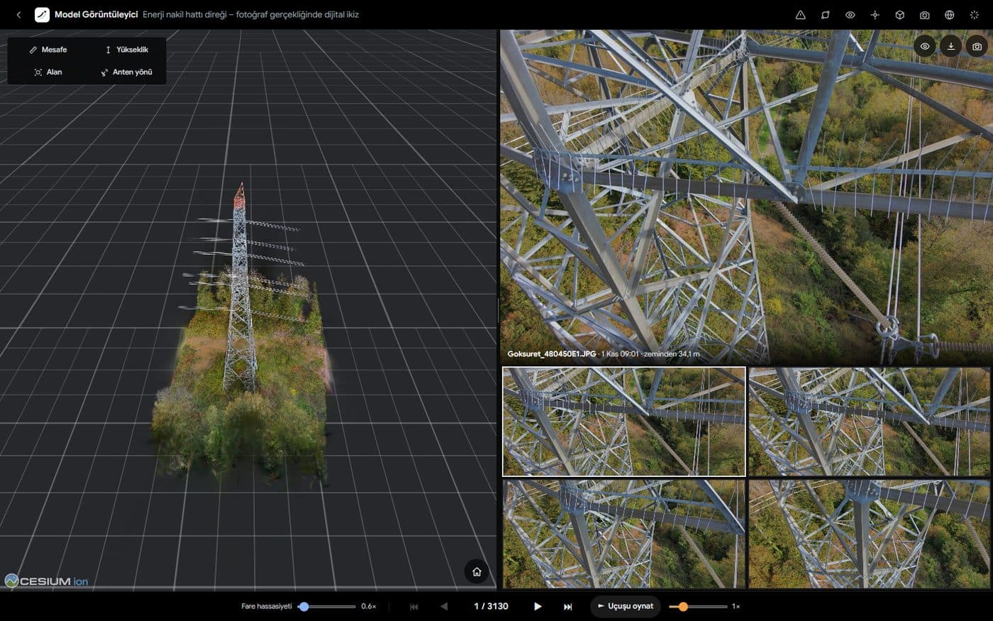
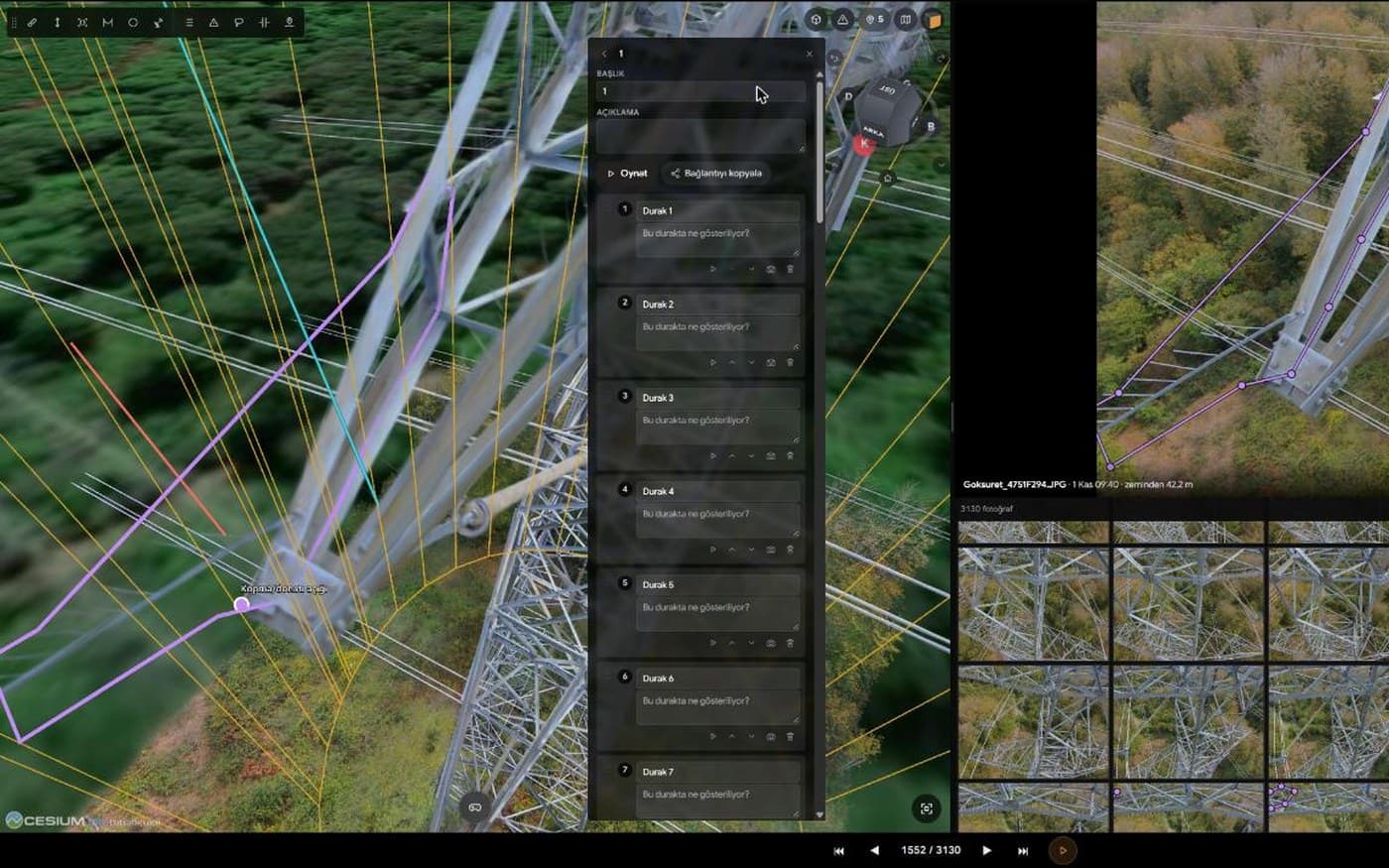
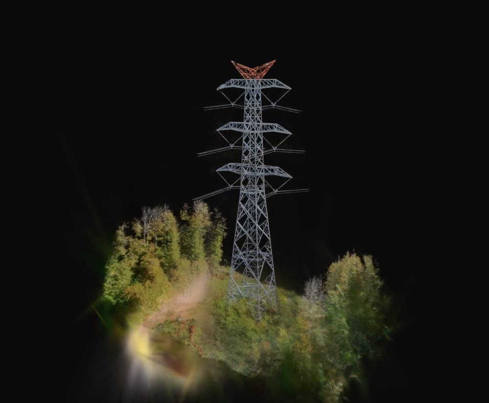
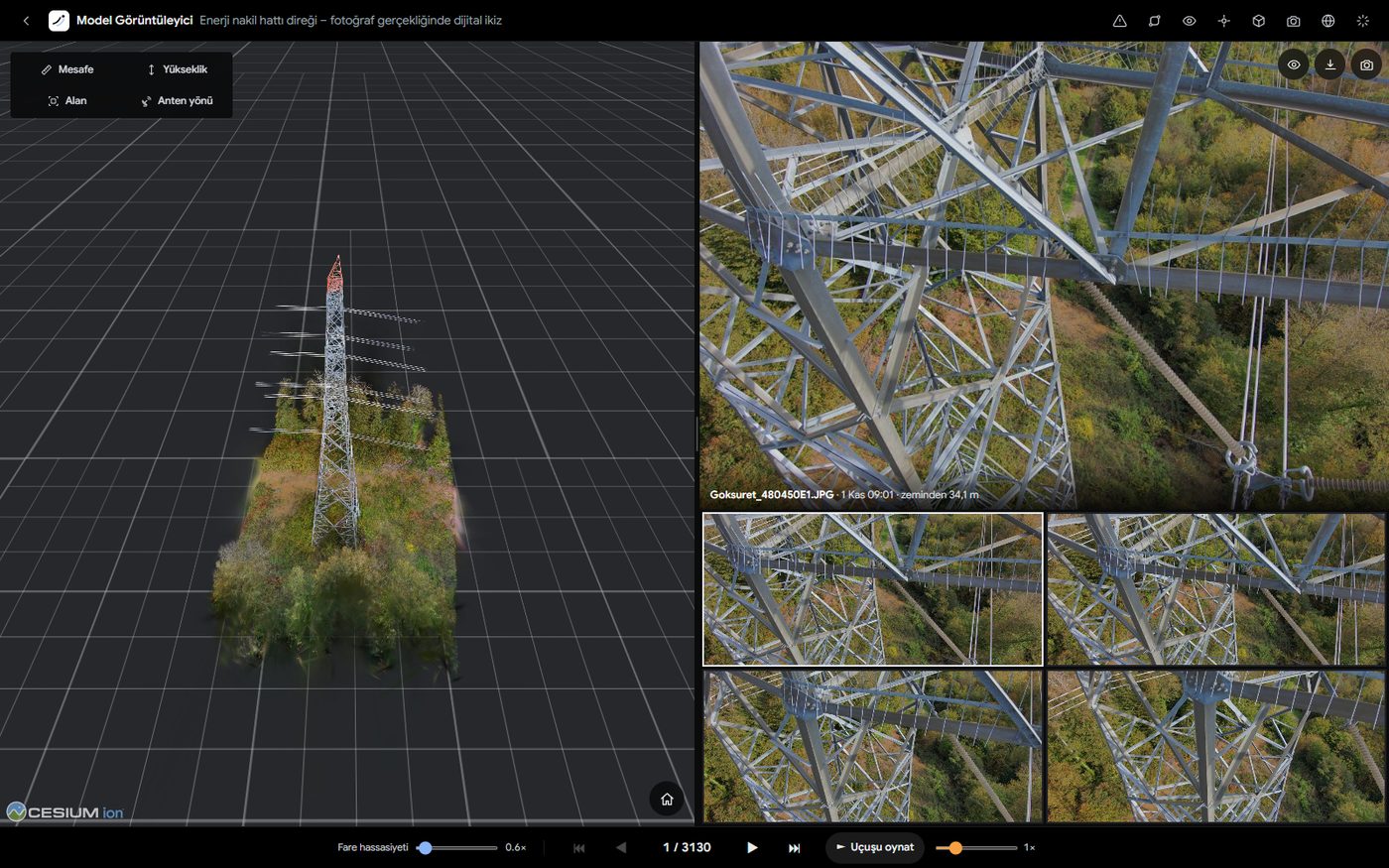
The whole structure in photo-real detail, in your browser. Orbit and zoom in; lattice members, insulators and conductor fittings are all in place. Switch the twin off and the same scene stays as a point cloud, which is what measuring and picking work on. Nothing to install.
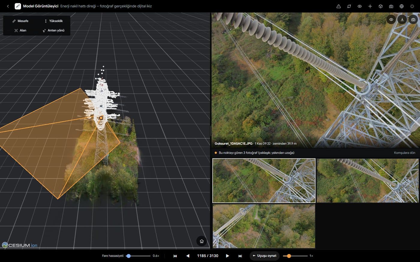
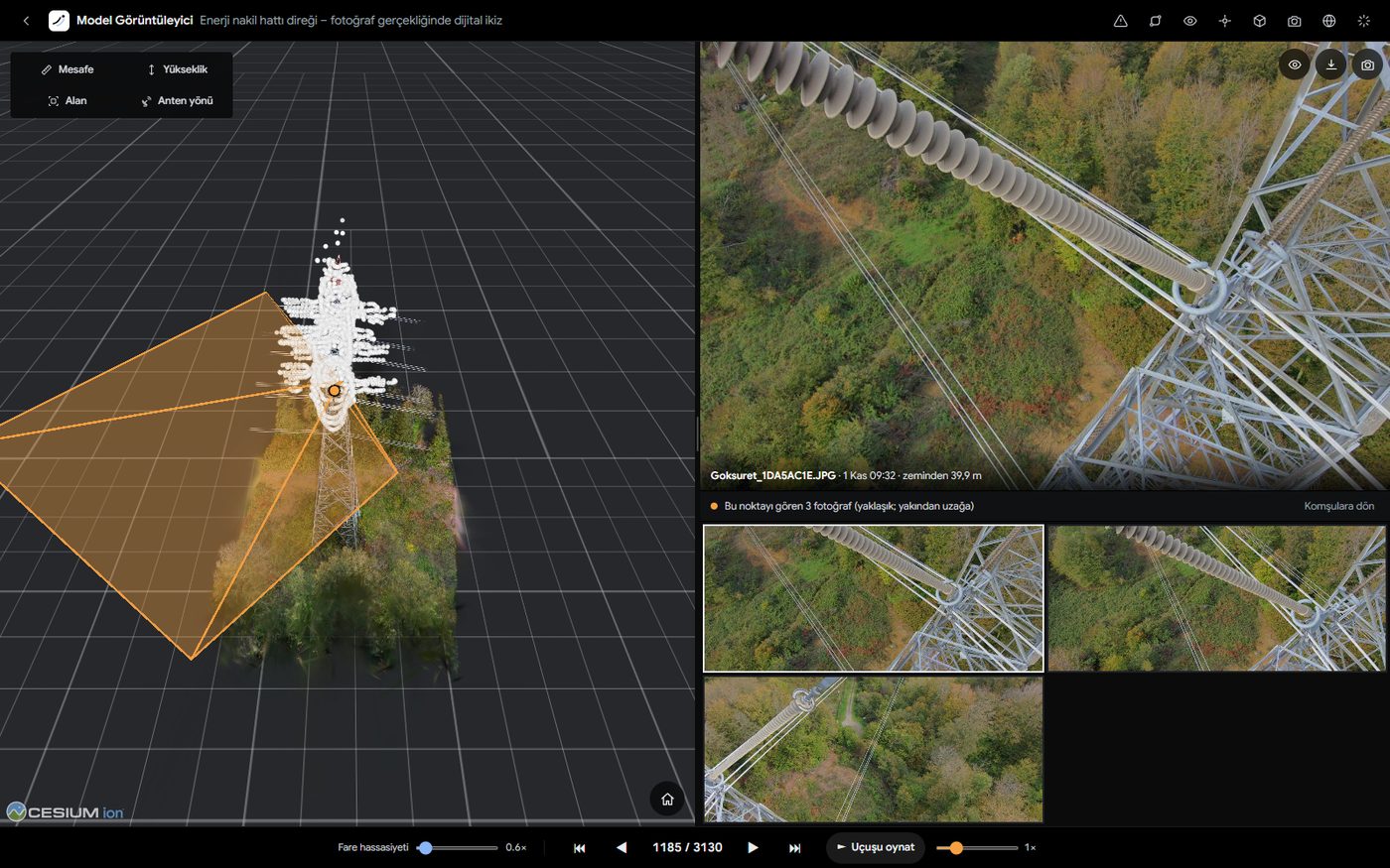
Click a point on the model: the original photos that see it are listed nearest first, and the closest opens at full resolution. Where each photo was taken and which way it looked is shown on the model. Step to neighbouring photos with the arrows, or press “Play flight” to watch the whole capture in the order it was shot.
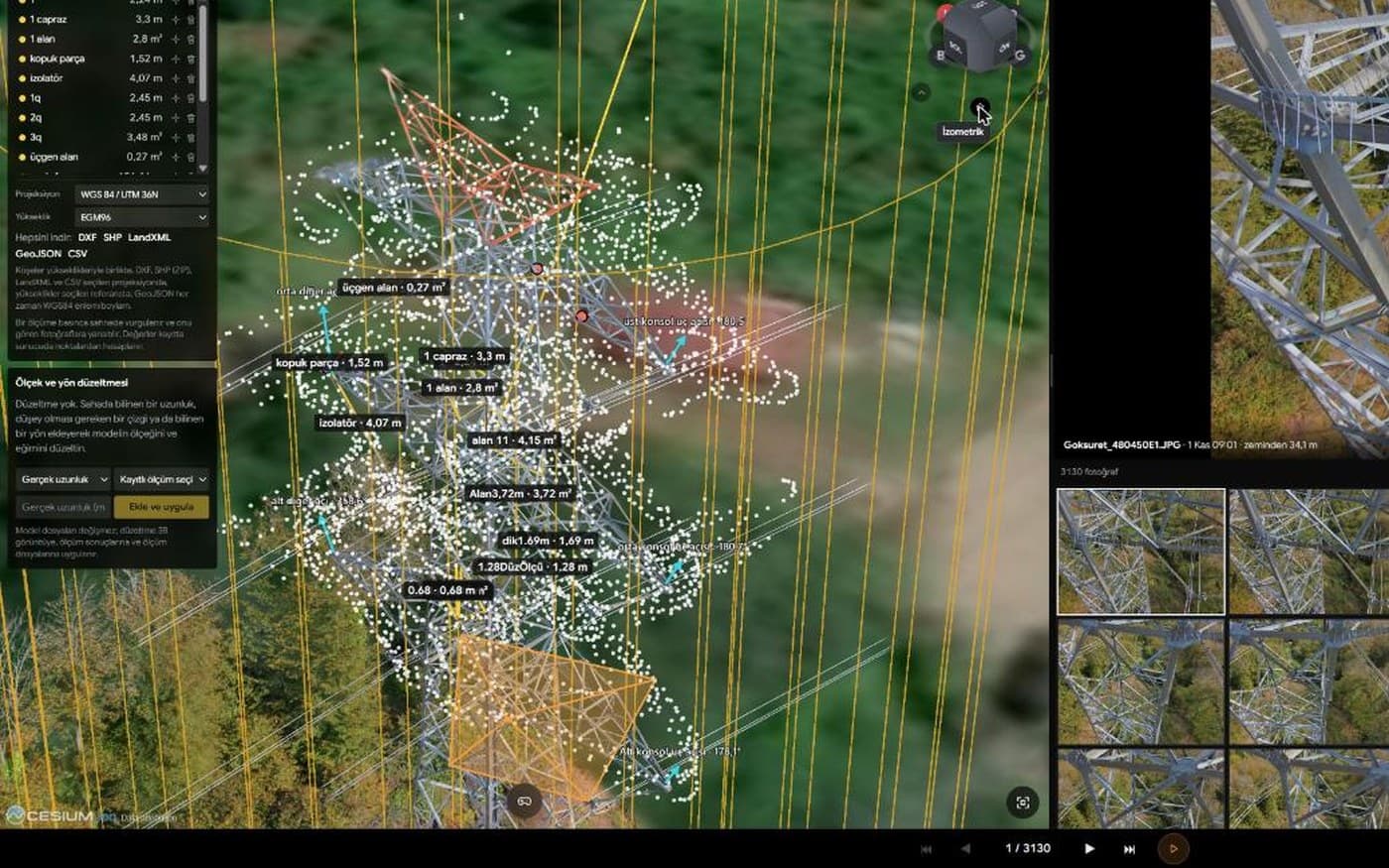
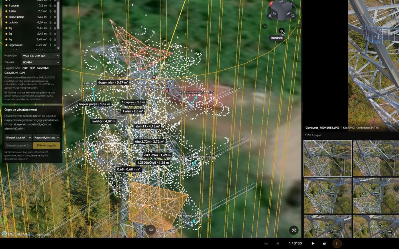
Measure distance, height, area and circles; get conductor sag and the direction an antenna faces. Measure on the model or directly on a photo. Name measurements, sort them into layers and save them; saved measurements appear in the report and in exports.
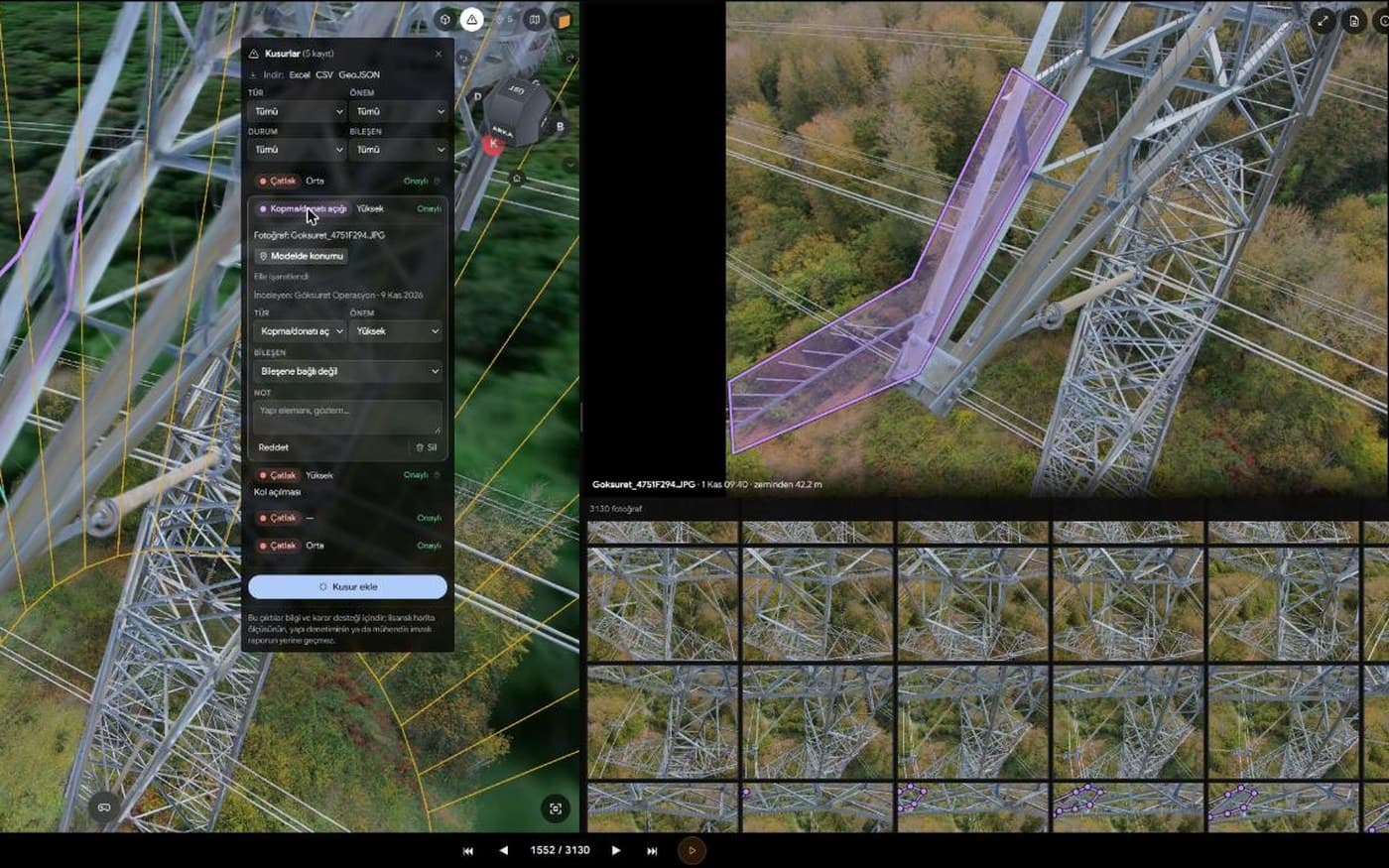
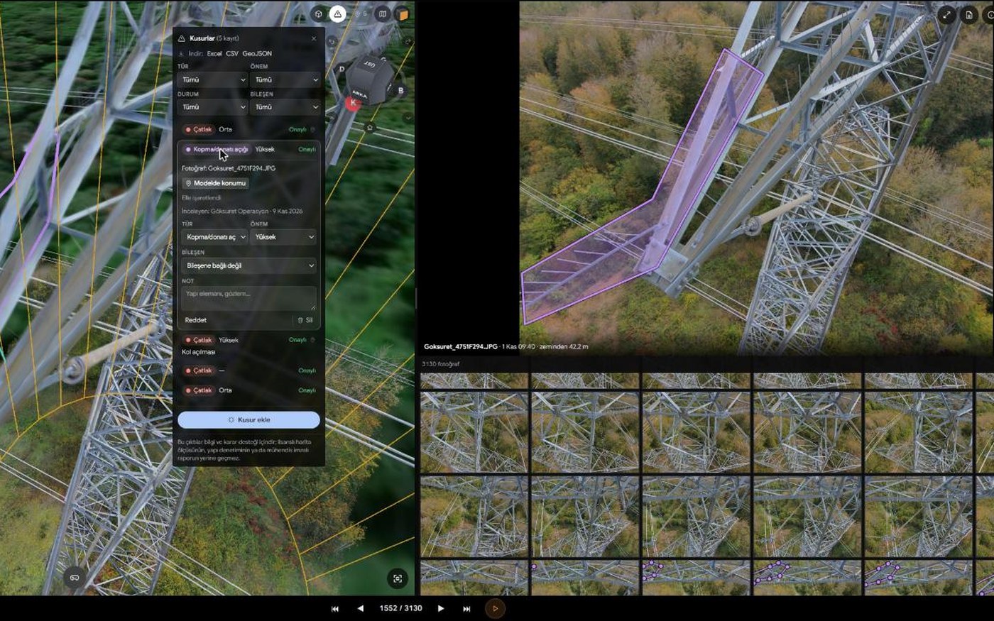
Outline the defect on the photo and add its type, severity and a note. The record keeps its 3D position on the structure, so the same defect shows on the model and on the other photos that see it. Findings are listed, their status is tracked, and they are delivered with the report.
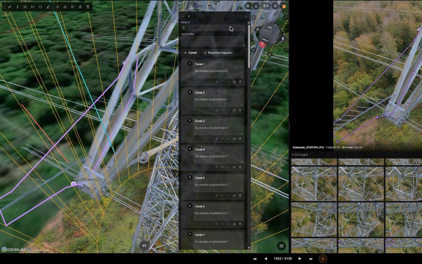
Add the views you visit as stops, in order; give each a title and a note, and link a defect or a measurement. The tour plays back step by step as a presentation. You can also record the scene, with its measurement labels, as an MP4 video or a single image.
PIN-protected, time-limited share links and QR codes; whoever opens the link explores the model without an account and, if you allow it, measures. Roles and per-person permissions for your team, comments and notifications inside the project. Models captured on different dates are compared side by side with a curtain.
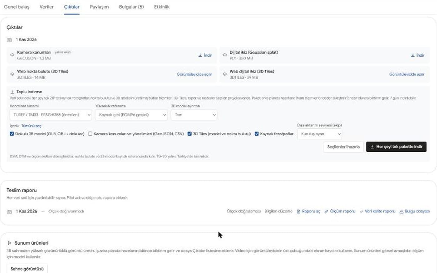
Textured model (GLB, OBJ), point cloud (LAZ, LAS), digital twin, original photos and a PDF report. Pick the files you want; you are notified when the package is ready.
Who it's for.
Telecom
Tower inventory, antenna and equipment inspection, without climbing.
Energy
Transmission and distribution pylons, substations, solar and wind sites.
Transport infrastructure
Bridges, viaducts, culverts, road and rail structures.
Maritime and ports
Ship hulls, decks and superstructures; shipyards, quays and port cranes.
Construction and real estate
Digital twins, progress tracking, earthwork and stockpile volumes.
Industry and logistics
Plants, warehouses, tanks and pipelines, interiors included.
Heritage and public sector
Ancient cities, rock-cut tombs, rock formations, tumuli; visual 3D documentation of historic and public buildings.
- Let's talk
Not seeing your sector?
Tell us about your structure and what you need; we will plan the flight around it.
Our work
Shared with our clients' consent
A selection of delivered projects. Locations and client details are not shared.
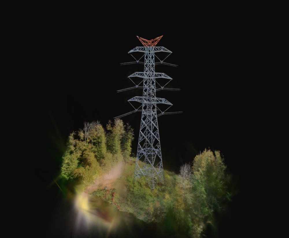
Transmission line tower — photoreal digital twin
The whole lattice tower captured as a photoreal 3D twin: steel members, insulators and joints can be rotated and zoomed full screen in the browser.
2026
In Göksuret Cloud
Inspect the tower from your desk
Real Cloud screens from our own power-line tower capture: explore the twin, replay the flight, open the photo that sees a point, mark a defect, measure, build a tour and share it.
Let's talk about your site.
Describe the area and what you need; we'll come back with a flight plan and a quote.